- LA9. Integrated Services for the Geoenvironment
Coordination: Orquídia Neves, IST
Co-coordination: Mª Rosário Carvalho, FCUL
Institutions: FCUL, IGOT, IPCB, IST, LNEG, UA
Action line that promotes the integration of several working groups for the provision of services in geoenvironment, contributing to the sustainability of geological resources.
It aims to identify and enhance the use of C4G resources necessary to perform integrated services in Geoenvironment, through the identification, characterization and monitoring of geoenvironmental parameters.
+ PRODUCTS
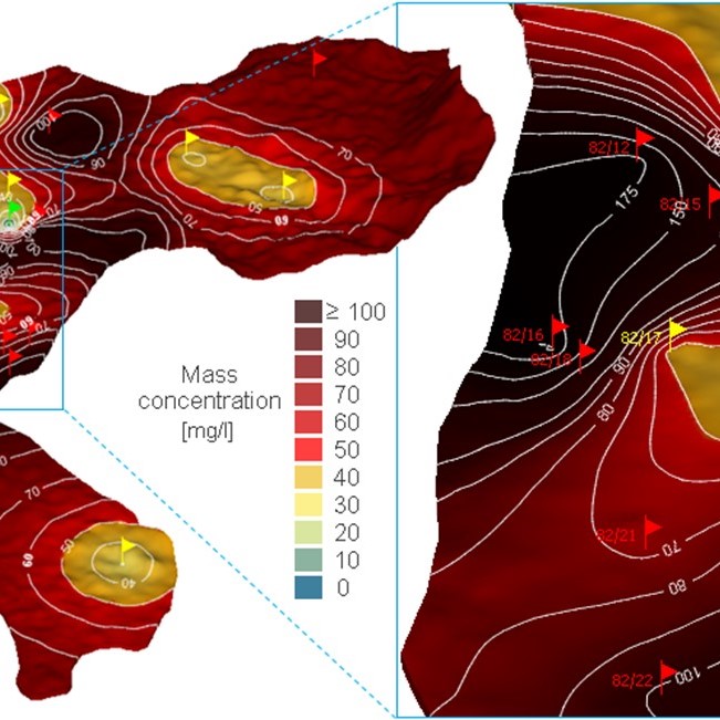
- Geoenvironmental, morphological and geomorphological maps
- Aquifer contamination vulnerability maps
- (Available soon)
. Geochemical maps (rock matrix, soil, water)
. Geoenvironmental vulnerability maps
- (Available soon)
+ SERVICES
- Identify and or evaluate geochemical anomalies in different sampling media (surface and groundwater, soil, plants)
Detection of geogenic anomalies, based on the quantification and distribution of physical-chemical and mineralogical parameters analyzed in the sampling media under study and/or evaluation of their importance and environmental hazard. - Modeling of geoenvironmental processes
Interpretation and prediction of the occurrence and transfer of aqueous, gaseous and solid species, considering the air, water, soil and rock. - Characterization of the geo-bioavailability of chemical elements
Determination of the geoavailable fraction (concentration of the chemical element of a geological material that can be released into the surface environment or close to the surface through mechanical, chemical or biological processes) of soils and sediments; Determination of the bioaccessible oral and pulmonary elemental fraction (amount of a chemical element that is released in the digestive and/or pulmonary fluids and that is potentially available to reach the blood circulation) from soils, dust, etc. - Identification and assessment of environmental vulnerability in different environments (e.g. aquifers, soils)
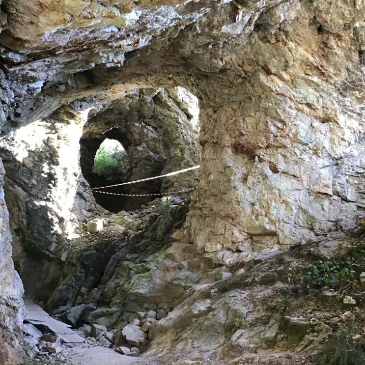
- Geomorphological mapping and natural risk zoning
- Characterization and multi-scalar analysis of geoenvironmental processes
Using different data sources (in-situ information, images acquired with UAV or satellite), relevant parameters to the study of a spatial phenomenon will be identified and characterized (e.g. digital elevation models, land uses, satellite products, geometric monitoring). The results can be presented graphically in vector or matrix format according to the nature of the phenomenon. - Plans and networks for monitoring geoenvironmental parameters
Plans and networks for monitoring geoenvironmental parameters: Establish monitoring plans and networks to monitor the spatio-temporal variation of geoenvironmental parameters (physical, chemical, mechanical) of the medium´s under study. Report with the plan and the best locations for monitoring. - Monitoring of geoenvironmental parameters
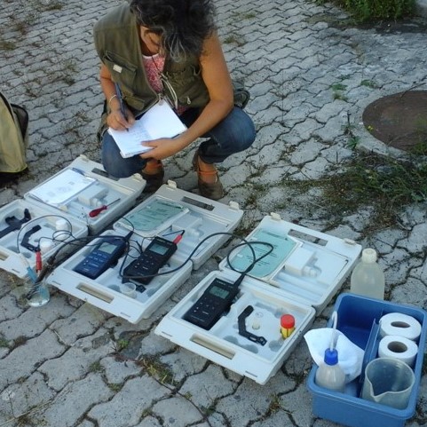
Sampling and monitoring the spatio-temporal variation of the physical chemical parameters (eg. pH, electrical conductivity, dissolved oxygen, salinity, Eh, anions, cations), or mechanical (eg. simple compression resistance, friction angle…), evaluated in sampling under study (eg, waters, soils, sediments, plants and rock masses). - Development of geo-environmental surveillance and alert systems
Consultancy, with case evaluation, from the definition of the sampling design, installation of sensors and definition of maximum allowable limits. - Definition of protection perimeters for groundwater abstraction
Delimitation of the protection areas for groundwater abstraction from contamination, with resources for hydrogeological studies, analytical methods and numerical methods of flow modeling and transport of contaminants. Consultancy, to be evaluated on a case-by-case basis. - Definition of protection and recharge areas of aquifers
Mapping of areas susceptible to aquifer contamination and areas of potential infiltration leading to aquifer recharge. Consultancy, to be assessed on a case-by-case basis. - Geoenvironmental characterization through the use of environmental isotopes (stable and radioactive)
Use of environmental isotopes (2H, 13C, 18O, 3H and 14C) to identify carbon origin in aqueous systems; in the definition of the preferential recharge altitudes in aquifer systems; in the determination of the apparent speed of groundwater flow; in the identification and quantification of mixtures between different water units; in the identification of salinization mechanisms in groundwater and, in groundwater dating (transit time, definition of flow lines, etc.).
+ TRAINING
- Modeling of geochemical processes
Learn to model chemical, thermodynamic and kinetic reactions, between water, gases and solids, to represent geoenvironmental phenomena and processes, using the PHREEQ program.
(21 h) - Remote sensing applied to the geoenvironment
Provide the basic knowledge to manipulate remotely sensed images along a complete processing chain, from data pre-processing to map creation and analysis: platforms, sensors and types of remote sensing data. Image processing techniques. Machine learning and classification. Change detection techniques. Spatial features analysis in earth and environmental topics.
(1 week, in-house)
- Medical Geology
Workshop consisting of several modules foccused on the impact of geological materials and their (un)voluntary application in ecosystems and human health.
(1 week) - Environmental management systems – ISO 14001 (2015)
Standard ISO 14001 – 2015 – what changes in relation to ISO 14001-2004
1. Requirements; 2. Areas of coverage; 3. Environmental audits; 4. Evaluation of environmental performance; 5. Life cycle analysis; 6. Environmental labeling.
(60 h, in-house or b-learning). - Potentialities of Isotopic Hydrology: a contribution to the protection and sustainable management of surface and underground water resources
Basic principles of isotopic techniques applied to hydrological studies: stable (2H, 18O, 13C) and radioactive (3H and 14C) isotopes: origin, preferred altitudes of the recharge areas, direction of underground flow, average residence time and age apparent increase in underground water resources. Process identification mixes between surface and underground water resources. Characterization and identification of the origin of the mineralization. Use of isotopic techniques to solve aquifer contamination problems (15N and 34S). Environmental isotopes in the assessment of saline intrusion versus dissolution of evaporitic minerals (sedimentary basins in coastal areas). Identification of the most suitable isotopic tool for solving a given hydrological problem.
(1-2 days; in-house or e-learning.)
Check more TRAINING available via C4G