- WG11. Laboratory of Marine Seismic Reflection and Bathymetry
- LA11. Marine Geology
Coordination: Pedro Terrinha, IPMA
Co-coordination: Carlos Ribeiro, UÉ
Institutions: IPMA, UÉ
Team consisting of a Laboratory unit for the acquisition, processing and interpretation of marine geophysical data (2D and 3D seismics, magnetics and gravimetry) and their geological integration – from estuaries to abyssal bottoms.
Aims to provide services to C4G partners, the national and international scientific community, the public and the private entities; to offer advanced training; to construct integrated geological and environmental models (geophysical, geochemical) for the characterization of the seabed and subsoil and crustal structure; to map the marine habitat; to assess marine geological risks and resources and; to integrate the international community on deep sea substrate research.
+ DATA & PRODUCTS
- Maps and grids of geophysical data
- Offshore geological maps
Sismostratigraphy, chronostratigraphy, lithology and morphotectonics
- Thematic geologic maps of the seafloor
Geomorphology, habitats, paleo-coast lines and landslides susceptibility
- MINEPLAT WebSIG (beta version)
Continental Platform of the Alentejo Margin, Portugal – includes the high resolution visualization of the seabed (multibeam probe), the visualization of the substrate structure through ultra high resolution multichannel seismic profiles and the estimation of the location and size of geological bodies with high magnetic susceptibility.
[here]
- (available soon)
- SEISLAB: Marine geophysical data repository. Online services of data and metadata. [here]
More sources of marine geology data: EMODnet-geology.
+ SERVICES
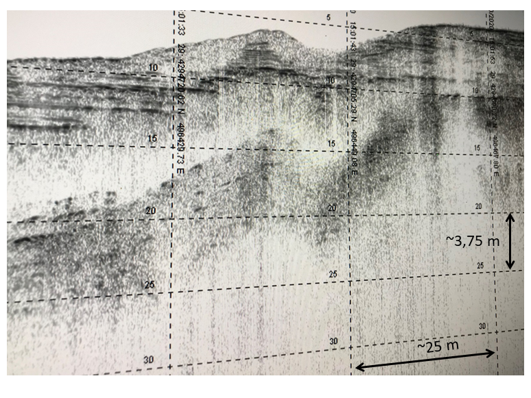
- Marine seismic reflection
Archive, acquisition, processing and interpretation.
- Marine seismic refraction
Archive, processing, interpretation and models of deep crustal structure.
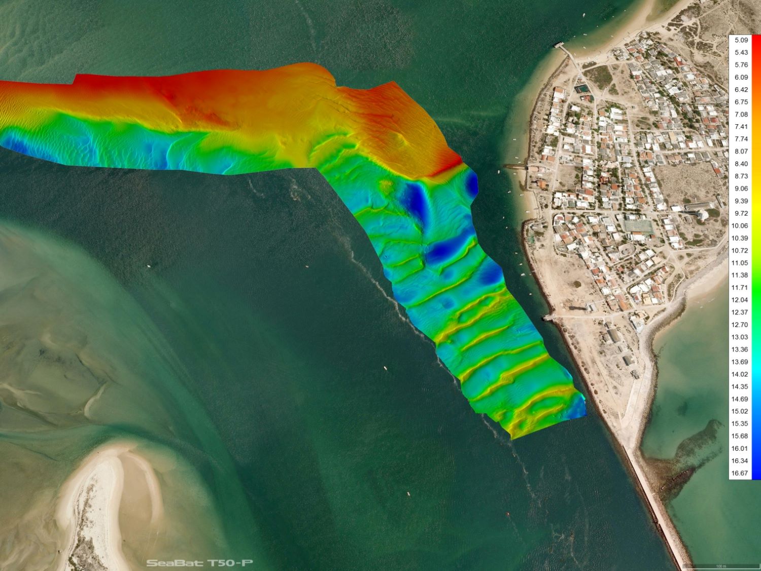
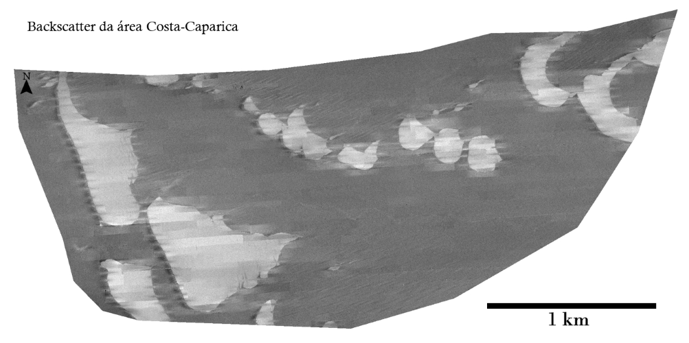
- Multibeam echosounder, bathymetry and backscatter
Archive, acquisition, processing and interpretation.
- Marine magnetic field
Archive, acquisition, processing & interpretation.
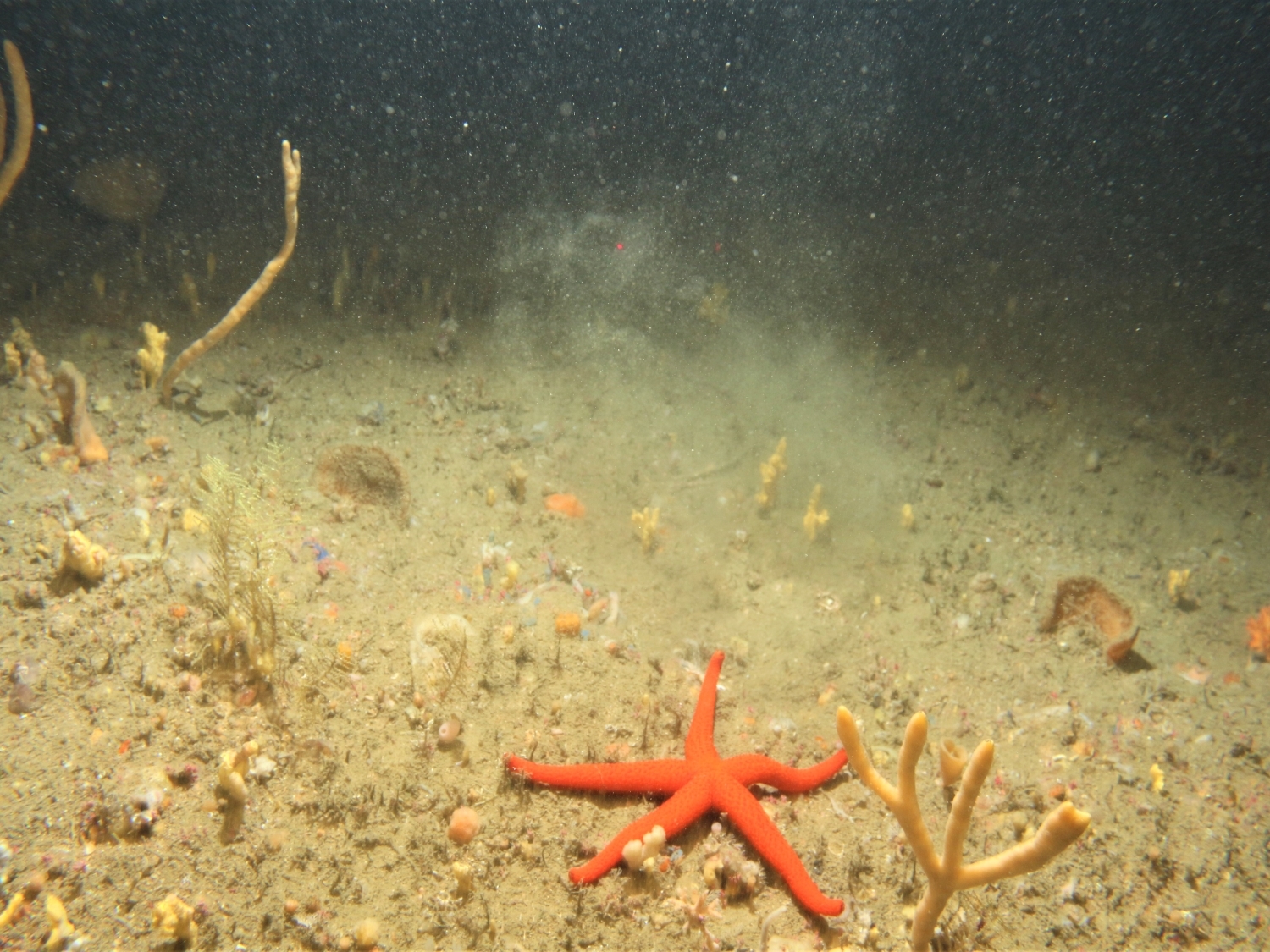
- Direct sea floor observation
Archive, acquisition of photographs and video
- Sound velocity profiles
Archive and acquisition
- Marine georesources
Identification of potential areas, methane hydrates, polymetallic nodules, high resolution characterization of marine aggregates and placers deposits
- Good environmental state and hazards
Littoral and estuarine sediment dynamics, active submarine structures (landslides, faults, anthropogenic structures) surveys and assessments
+ TRAINING
- Theoretical and pratical training
Processing and interpretation of geophysical data, curses in the 3 upper cycles in marine curricular areas tailored to C4G partners and stakeholders needs. In-house and e.learning.
Check more TRAINING available via C4G.
+ EQUIPMENT
- Ultra-high resolution multichannel seismic reflection spread: 1kJ pps, 24 channels, 200 tips sparker
- Sub-bottom profiler (parametric echosounder)
- Multibeam echosounder+SVP+Positioning system spreads
- STR SeaSpyder Telemetry underwater system, photo and video camera
- Valeport Sound Velocity Sensor & Profiler
Check more EQUIPMENT available via C4G.
+ LAB
- SeisLab – Lab. of marine seismic reflection and bathymetry:
- Workstations for seismic data processing and interpretation