- WG13. Monitoring of Permafrost Environments
Coordination: Gonçalo Vieira, IGOT
Co-coordination: António Correia, UÉ
Institutions: IGOT, IST, UÉ
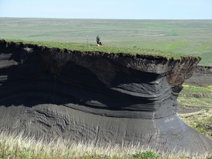
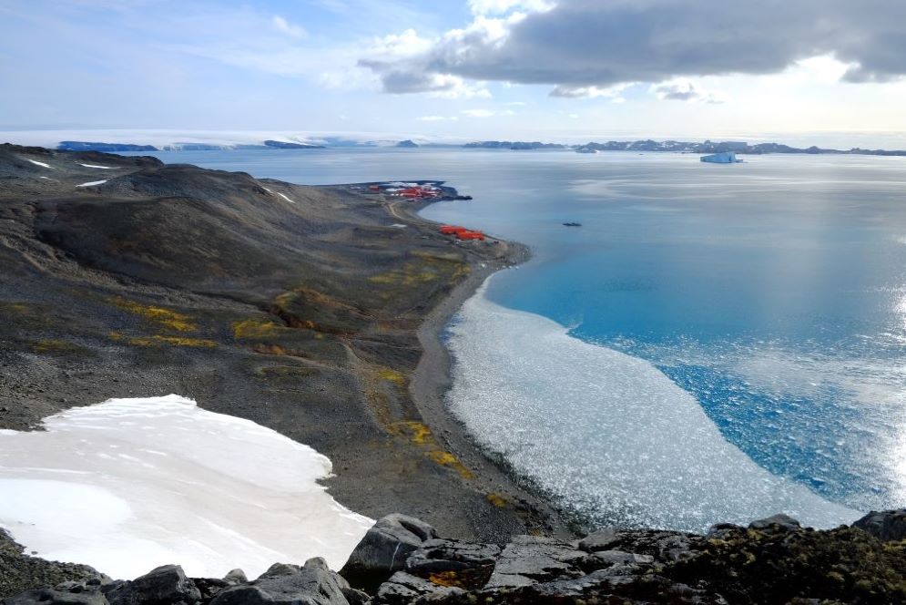
Working group promoting the study of permafrost in polar and mountain regions and facilitating access to data and equipment. Permafrost monitoring is carried under the PERMANTAR network of permafrost observatories in the Western Antarctic Peninsula region.
The group aims at creating conditions for the long-term maintenance of the PERMANTAR network, integrating them as a C4G infrastructure, to foster researchers’ access to PERMANTAR observatories and data, creating synergies for scientific and applied studies; and to consolidate national research in regions with permafrost.
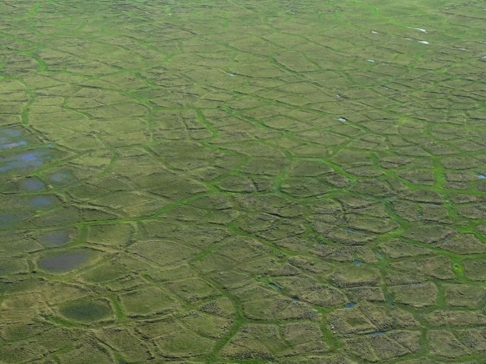
In the sort term, it aims to make available meteorological data, soil deformation data series, permafrost temperature from the PERMANTAR observatories of Western Antarctic Peninsula, and high resolution mapping of polar and high mountain environments (geomorphology, infrastructure, landcover).
+ DATA & PRODUCTS
- Permafrost ground temperatures of the Antartic PERMANTAR observatories of Western Antarctic Peninsula (.csv) [here]
Permafrost borehole data from the PERMANTAR network sites across the Western Antarctic Peninsula.
+ SERVICES
- Geoenvironmental hazard mapping in polar regions and mountainous regions (erosion rates, risk mapping)
Development of geoenvironmental assessment in remote extreme environments, including mapping and modelling using both in situ and remote sensing surveying methods.
- Environmental consulting in polar and mountainous regions
Consulting on diverse environmental issues for applications in extreme environments (geology, geomorphology, erosion, resources, hydrology, climate, remote sensing, etc.)
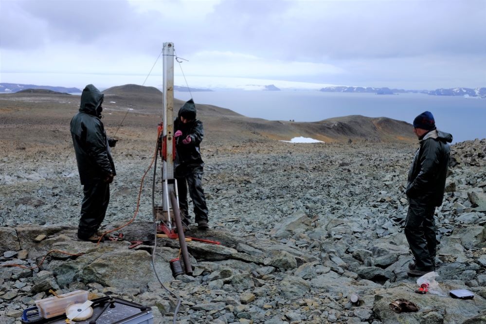
- Permafrost exploration by geophysical methods – electrical tomography
Geophysical surveying for subsurface prospection.
+ TRAINING
- (available soon)
- Courses on study techniques on high mountain and polar environments
Check more TRAINING available via C4G.
+ EQUIPMENT
- Fixed-wing and multicopter drones
- Optical and multispectral cameras
- Weather sensors + multi-channel dataloggers
- GPS and Total Station
- Drilling equipment for bedrock (up to 15 m depth)
- Soil auger and active layer thickness picks
- Electrical power generators
- Zodiac Mark V (in Antartica)
- Electrical tomography system
Check more EQUIPMENT available via C4G.
+ LAB
- GEOMODLAB – Lab. for remote sensing, geographical analysis and modeling:
- Workstations for data processing and analysis